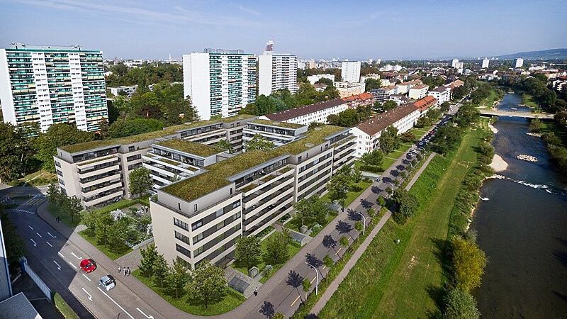
Basel Urban Labs
What is the aim of the study?
The Basel Urban Labs study - as part of the European research project EXPANSE - wants to compare the living environment of the Basel region with other European cities. We want to understand how various factors in the environment in which we live affect our health and how the complex environment affects our sleep, our movement and body weight, our stress levels, and our life satisfaction. Thanks to your participation, the Basel Urban Labs study could help politicians in the Basel region to consider health aspects in their planning.
Why is this important?
Where we live influences our well-being very much. Where we live and work determines how much air pollution or traffic noise we are exposed to. Greenspaces such as parks, gardens, forests or sports fields at home or at work influence our leisure activities. The connection of our home to public transport, to pedestrian-friendly paths, and to facilities such as banks, cafés, fitness centres, and healthcare centres is important for our social life and for our health care. What restaurants and grocery stores we have access determines our diet.
Who participated?
A random sample was selected from the population register of the canton of Basel-Stadt. Participants had lived in the Canton of Basel-Stadt for at least one year and were at least 18 years old. Inclusion criteria included: understanding German, owning a smartphone, having access to the Internet, knowing how to install apps on a smartphone, and having no difficulty carrying small devices (GPS, air quality meters) for two weeks.
What did participation involve?
At the beginning and throughout the study period until December 2024, participants regularly completed short questionnaires and several 30-minute questionnaires online or via a smartphone app developed for the study. The participants' mobility behaviour was measured on an individual basis during a two-week measurement period. All participants received a GPS tracker for geolocation and a silicone wristband for later measurement of airborne chemicals. Some were also given a device to measure their personal exposure to particulate matter while travelling and at home. On the last day of the measurement period, participants were asked to give a few drops of blood from their finger. An activity diary was kept for four days of the 14-day measurement period. In the second year of the study, some of the participants were invited to take part in a second personalised measurement period, especially those who had moved house.
What are the specific outputs of the study?
At the end of the EXPANSE research project, we aim to develop an interactive tool that will allow people living in Basel to assess their risk of cardiovascular disease, diabetes or chronic lung disease based on their home address and their answers to additional questions.
The Urban Labs study was conducted simultaneously in Basel, Amsterdam, Athens, Lodz and Barcelona. In the medium term, the aim is to be able to compare personal exposure, for example to noise, with that of other people in Basel or other European cities.
What scientific results have already been published related to the study?
Here you will find a list of articles that have recently appeared in some of the most prestigious journals and to which EXPANSE researchers have contributed: https://expanseproject.eu/publications/
EXPANSE results: publications by Swiss TPH researchers
Exposome profiles and their influence on average lung function in the population in the age of climate change
As part of the EXPANSE project, a pooled analysis of eight population-based European cohorts was conducted to investigate the relationship between complex long-term exposome profiles (consisting of air pollution, green space and temperature to which individuals are exposed in their environment) and lung function. It has long been proven that better air quality and more green space are protective factors for lung function. This analysis now also includes the impact of climate change. The results suggest that climate change has a negative impact on lung function. In adults and, to a lesser extent, in children and adolescents, climate change scenarios appeared to mitigate the positive effects of improved air quality or more green space on average lung function (FEV1).
https://www.sciencedirect.com/science/article/pii/S0160412025000200?via%3Dihub
Air pollution and fewer green spaces at home appear to increase the risk of stroke
Data from around 15 million European participants (adult cohorts from Germany, the Netherlands and Sweden and administrative regional, municipal or nationwide register cohorts from Catalonia, Rome, Greece and Sweden) were analysed. Elevated NO2 and soot levels were associated with an increased incidence of stroke. More green space at the participants' place of residence was associated with a lower incidence of stroke. In built-up areas, more green space and less sealed surfaces appear to reduce the risk of stroke. No significant associations were observed with temperature parameters.
https://www.sciencedirect.com/science/article/pii/S0160412023004099?via%3Dihub
Total mortality is proven to be linked to the distribution of air pollution, built or unbuilt environment and temperature
The EXPANSE project investigated the independent and combined effects of air pollution, ambient temperature and built or unbuilt environment on total mortality. Data from over 3 million deaths in Europe (adult cohorts from Germany, the Netherlands and Sweden and administrative regional, urban or nationwide register cohorts from Catalonia, Rome, Greece, Sweden and Switzerland) covering approximately 204 million person-years were examined.
Increased air pollution (PM2.5, NO2 and soot values) was associated with increased overall mortality. More sealed surfaces and increased average seasonal temperatures appear to increase overall mortality. Increased PM2.5 exposure combined with low green space is associated with higher overall mortality than increased PM2.5 exposure combined with more green space. A combination of the environmental factors of temperature, air pollution, low green space and more sealed land was more strongly associated with overall mortality than each risk factor individually.
https://www.frontiersin.org/journals/epidemiology/articles/10.3389/fepid.2023.1328188/full
EXPANSE Results: Exposure Maps of the Canton of Basel-Stadt

Modelled NO2 pollution in 2019, annual average per 25 m x 25 m. The WHO limit value for the annual average of NO2 is set at 10 µg/m3. Currently, the limit value in Switzerland is 30 µg/m3, but the Federal Commission for Air Hygiene recommends lowering it to the WHO limit value.

Modelled fine particulate matter (PM2.5) pollution in 2019, annual average per 25 m x 25 m. The WHO limit value for the annual average of PM2.5 is set at 5 µg/m3. The current limit in Switzerland is 10 µg/m3, but the Federal Commission for Air Hygiene recommends lowering the limit to the WHO limit.

Modelled ozone pollution (O3) in summer 2019, average value per 25 m x 25 m. The WHO limit value for the summer season average of O3 is set at 60 µg/m3. The Swiss Federal Commission for Air Hygiene recommends introducing the WHO limit value for the summer season. Currently, a season-independent 1-hour average value of 120 µg/m3 applies to O3 in Switzerland (i.e. the 1-hour average value of O3 may be exceeded at most once per year).

Modelled temperature distribution in 2020, annual average per 1000 m x 1000 m.

Modelled accessibility index in 2020, average value per 100 m x 100 m. The higher the value, the more accessible the built environment is for pedestrians. White squares are considered inaccessible.

Modelled green space index in 2020, average value per 250 m x 250 m. The green space measured using NDVI refers to all vegetation, including structured areas in parks and gardens as well as unstructured areas such as forests. The higher the value, the greener the area, regardless of whether the area is accessible to pedestrians.

Modelled index of sealed surface area (sealing), in 2018, average per 100 m x 100 m. Sealing refers to the covering of surfaces with impermeable materials such as asphalt and concrete. The higher the index, the more heavily sealed the surfaces are.
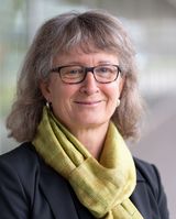
Study Lead
Read more about the EXPANSE project:
Frequently Asked Questions
We are currently (April 2025) processing the data and plan to send personalised feedback to all Basel Urban Labs participants in the coming months.
In future, chemicals or molecules produced by the body will be measured in the blood to better understand how environmental pollution can lead to disease. Metabolome analyses are planned. We are currently seeking funding for these measurements. Because the laboratory analyses are part of a research project, they do not meet the quality standards of clinical diagnostics and therefore participants will not receive individual results. Only if a chance finding is made that is clearly relevant to health would the participant be informed, provided they had indicated this in their consent to participate in the study.
Participants were able to indicate their preferences for the measurement period (months). They were then contacted to set a start date that best suited them.
Yes, participants were allowed to spend time outside the canton of Basel-Stadt during the measurement period.
It was important that participants' mobility behaviour during the measurement period corresponded as closely as possible to their everyday mobility behaviour so that the measurements taken during this period were representative of them. If participants regularly spent time in neighbouring countries as part of their everyday routine, this was not a problem if they also did so during the measurement period.
Yes, even if people did not have daily activities outside the home, they could still participate in the study. They also make an important contribution to the study.
No, when participants were not out and about, for example when they were at home or at work, they did not have to carry the GPS tracker with them. However, the GPS tracker should be in the same building as the participant.
EXPANSE is a project funded by the European research programme Horizon 2020.